2025 Sea ice drift on RV Kronprins Haakon
On Friday May 2nd, 26 scientists from thirteen different countries boarded the icebreaker RV Kronprins Haakon for a five-week scientific cruise into the pack ice north of Svalbard. This cruise is the first field campaign of the Micro-SHIFT project and has been organized as a drift campaign, meaning we will moor the boat to a single ice floe and take daily samples of that same piece of ice over a 20-day period. In this campaign we will target the unique microbes of sea ice ridge features - formed when pieces of free-drifting ice smash into one another - as well as the bottom-ice diatom bloom that typically grows at this time of the year. Follow our journey as we drift in the Arctic sea ice pack!
May 4, 2025
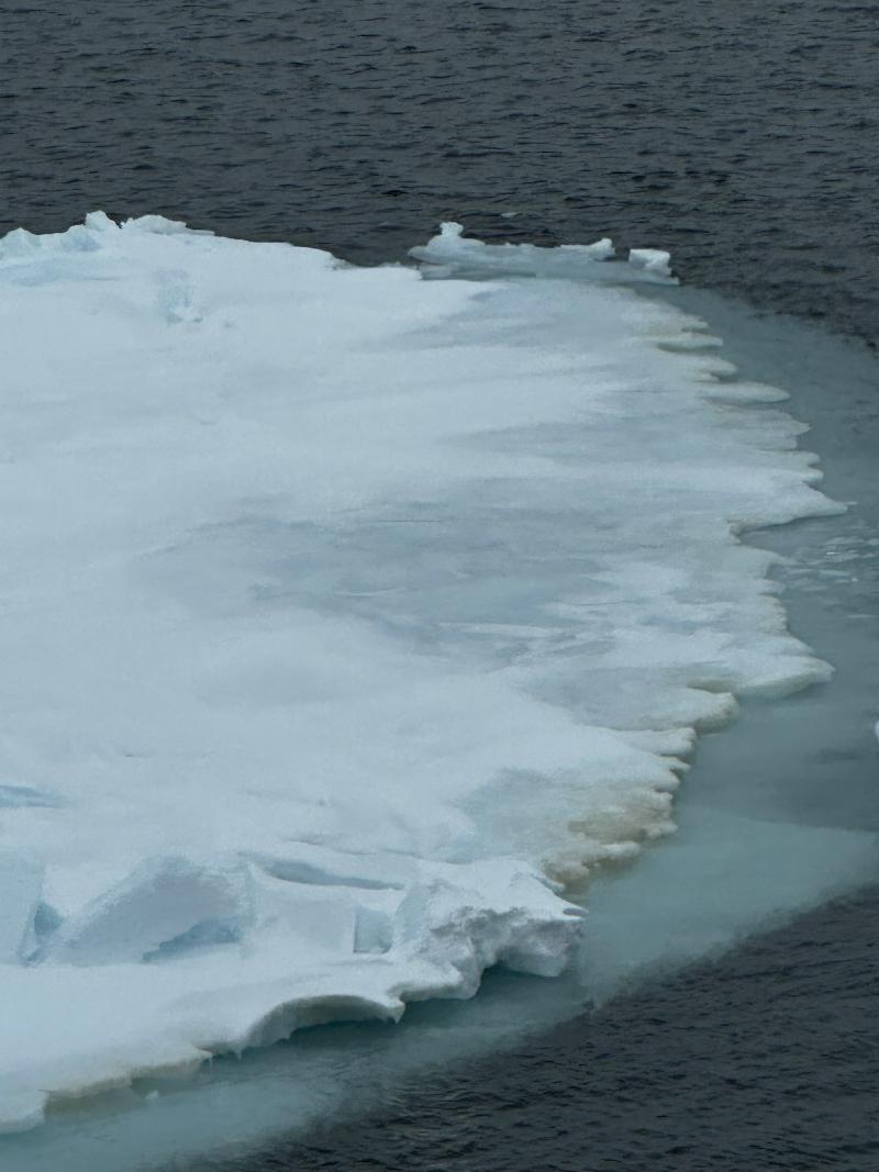
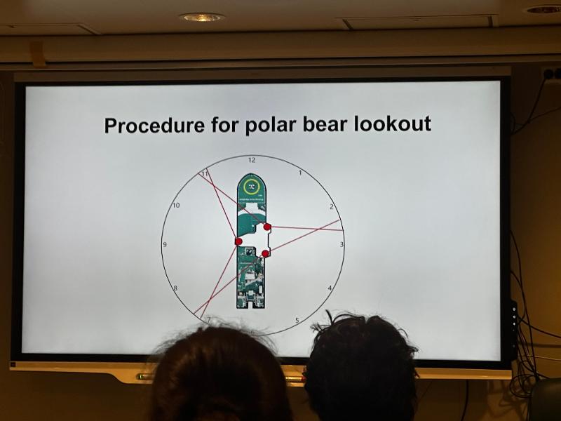
Be aware! Science and safety in the polar bears' home
(Credit: Megan Lenss, PhD Student @ NPI, UiT & iSi BIO laboratory)
May 6, 2025
The first ice
(Credit: Georges Kanaan, PhD Student @ University of Washington)
Sitting in the mess room having dinner with friends and colleagues. The food on board is usually good, comforting with a myriad of fats, carbohydrates and proteins. You can tell the chief steward is getting you ready for hard work, we never go more than 3:30 hours without a meal or snack. At this point we are almost a week into the cruise, we have time to get acquainted with each other, and the ship is already buzzing with scientists running around unpacking equipment, cleaning labs, setting up filtration stands, preparing checklists, and anticipating. Preparing.
Expeditions like this are planned many months if not years ahead of time, anticipation has been a growing part of the chief scientist’s day-to-day for a long while now. For others, it started a few months ago, but what is certain is that as we leave port we are all anticipating the four weeks of intensive work to come. You will read here about the science being done aboard this cruise, but there is so much more. The preparation is endless and the number of components that must be prepared seemingly uncountable. Planning continues until the point at which we are anchored in our sea-ice floe, and finally, unleashed onto it to execute our carefully developed experimental plans. It is then that the hard work can begin.
Perhaps this is why as I was sitting at dinner a few questions kept circling back into conversation, even though we had discussed them earlier at lunch today, and at dinner yesterday, and at lunch yesterday… "So when do you think we’ll get there?", "What type of ice do you think we’ll get?", "How far north will we make it?" (That last one always had someone half jokingly answer: the north pole!). Like bees in a winter hive, we long for spring. And it is at this moment that the first ray of sun shined through to our hive.
"Look! Ice!" Through the big windows of the mess room a small lonely piece of sea ice could be seen drifting slowly past the ship. We are close. I love this time of a cruise, I feel like the first glimpse of sea ice is a breadcrumb marking the path towards the gate of the Arctic Ocean. I follow the breadcrumb. I finish dinner faster than usual, run down to my cabin, grab the camera, run up to the 9th obervation deck, catch my breath, open the door, go outside, and… I’m cold.
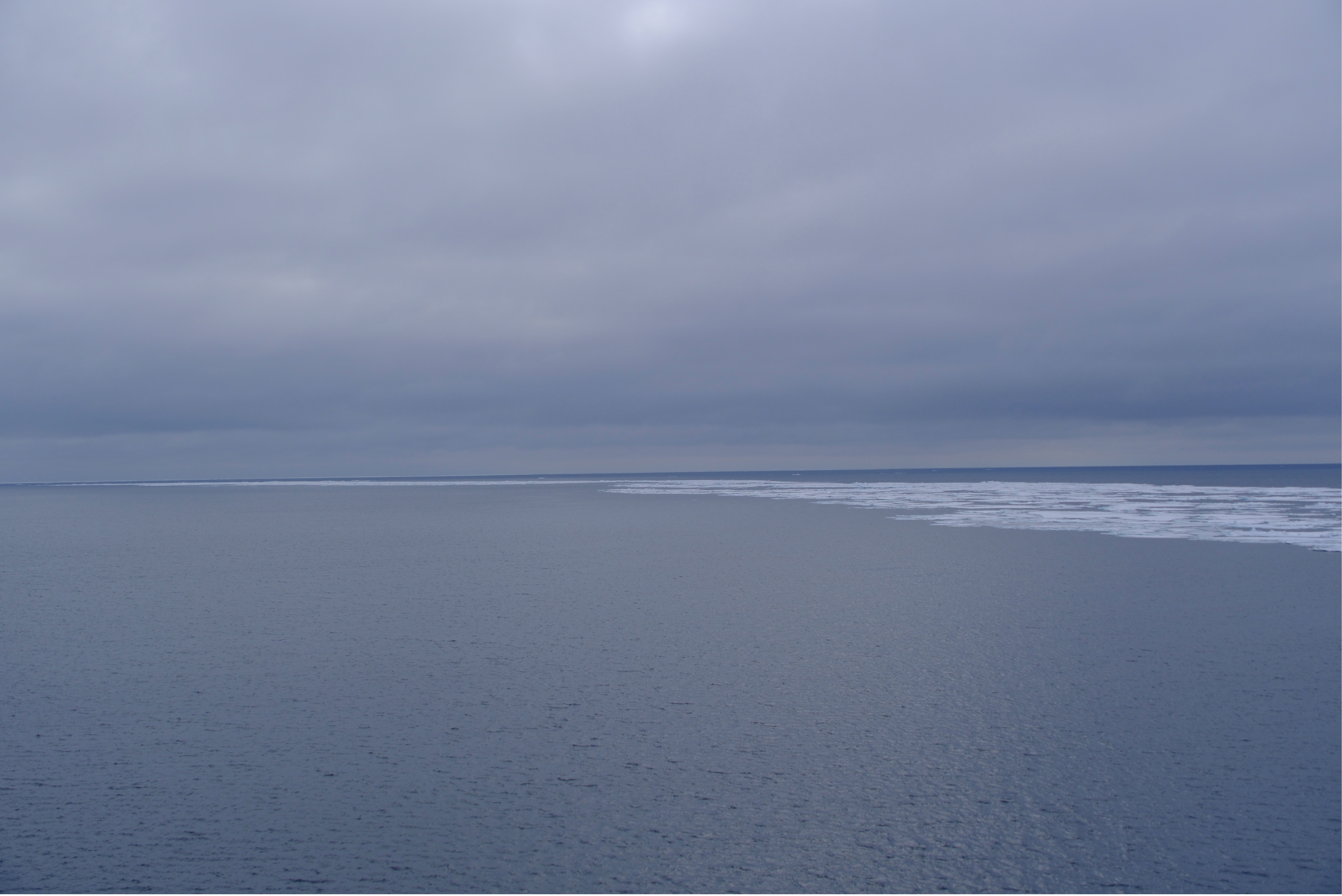
Forget the cold for now, I just forgot my jacket: look. Far in the distance, right before the horizon, the ocean seems to shine brightly, a beacon for our ship. That is the white sea ice, reflecting much more of the sun’s light than the dark blue ocean we’ve been sailing on. That function is part of what keeps our Earth cool it radiates heat back to space, and that’s also why losing it leads to more warming. "There it is", I think to myself "the gate to the Arctic", I am arrogant enough to feel myself welcomed by it. But I do not belong here, no human does, not this far north, not this far from the coast. Still, I like to think that the ice is curious, "How did he get here?", "How far will he go before he gives up?", all good questions. I know I am here because of very purposeful decisions and a lot of hard work, one does not end up at 83°N 21°W by chance. I am here to understand how this beautiful ecosystem works, what role it plays as a part of life on our planet, and how we humans are affecting that role and what that means for us. I like to think the ice sends little feelers out ahead into the ocean, "What are you doing here?" Perhaps it can tell I have good intentions at heart, and then it lets me pass.
May 7, 2025
A first encounter.
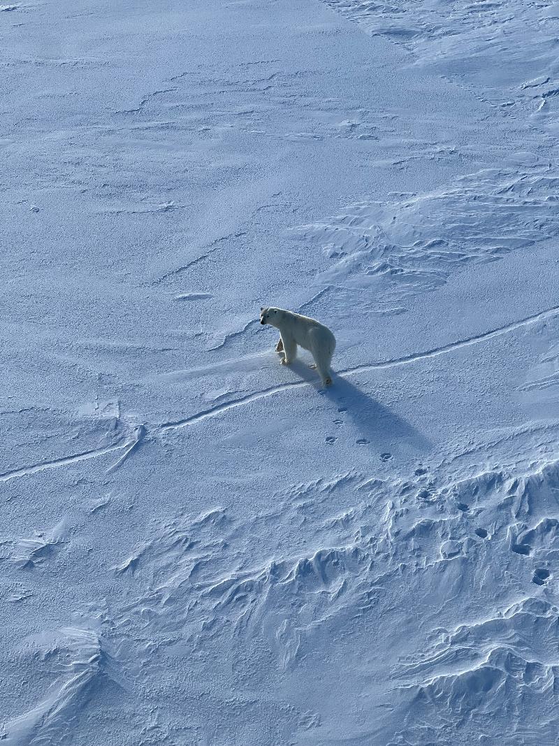
A polar bear is spotted while en route to the start position of our home sea ice floe. Most are excited and race to catch a glimpse of isbjørn (Norwegian for polar bear). The enthusiasm however is not shared by the Chief Scientist who would like to see nothing but algae this trip.
_________________________________________________________
10 May, 2025
Welcome to 'The Kindergarden'
(Credit: Karley Campbell UiT & iSi BIO laboratory, Micro-SHIFT PI)
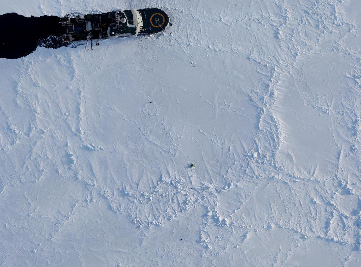
We have made our way north from Tromsø, past Svalbard and over the Yermak plateau, into the deep basins of the central Arctic Ocean. The water depth here is over 4000 meters. The sea ice floating above this vast ocean is fragmented, with individual ice pieces (or floes) that vary in size from one-to-many kilometers. Today we choose one floe to stay with for our drift. For it to last the coming weeks and support our science goals, the floe must be about 10 km in size. It must have ridges as well as smooth surface features. It needs access to an opening of water known as a lead – and crucially, it must survive the icebreaker securing itself about 300 meters into the floe. One crack of the ice during the parking operation could have devastating consequences for the integrity of the floe and our science. A few potential floes are attempted and unfortunately abandoned, but in the early morning hours the icebreaker is secure.
The home floe is quickly nicknamed ‘The Kindergarden’ because it has several ridges acting to fence in an area of smooth ice that will be a focus of our playful operations. First we must install equipment and make several holes of nearly 1 x 1 meter (covered in the photo below by a green tent) so that instruments like remotely operated diving vehicles can be put into the water underneath the sea ice.
11 May, 2025
(Credit: Karley Campbell UiT & iSi BIO laboratory, Micro-SHIFT PI)
_________________________________________________________________________________________________________
11 - 30 May, 2025
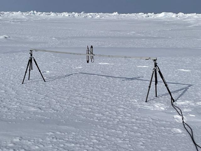
Micro-SHIFT scientists work hard during the drift to ask (and answer) important questions about sea ice and the microbiology that it supports.
_________________________________________________________________________________________________________
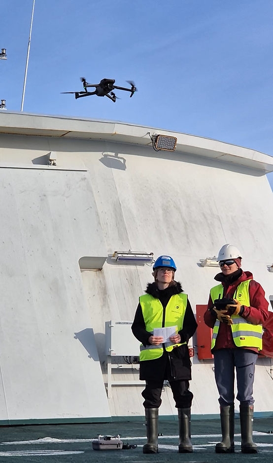
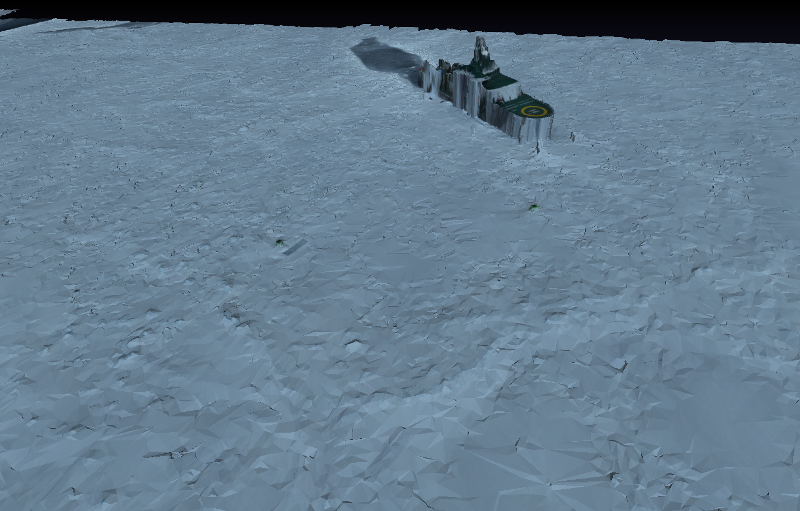
Fly high! Drone flights to map our home floe
(Credit: Anne Braakmann-Folgmann and Catherine Taelman @ UiT & Earth Observation Research Group)
_________________________________________________________________________________________________________
Are Arctic algae helping to reduce greenhouse gases in the atmosphere?
(Credit: Diana Varela & Shea Wyatt @ University of Victoria, Canada)
We are studying how fast sea-ice and floating (phytoplankton) algae grow under different nutrient and light conditions during the Arctic spring. This study will tell us how much algae is there and how active they are. This is important because these algae feed the Arctic marine food web!
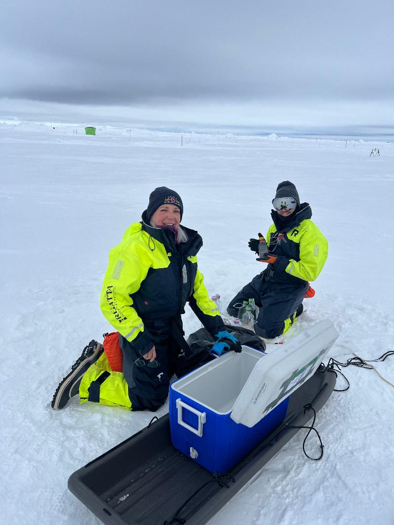
If we want to understand the effect of algae on reducing CO2 in the atmosphere, then we need to better understand how much CO2 fixed by algae at the top of the ocean (either floating or growing in sea ice) travels to the bottom ocean. To address those questions, we added various nutrients to water and sea ice samples: carbon, nitrate, ammonium, urea and silicic acid. We “spiked” samples (in colour-coded sealed acrylic bottles) with very small amounts of stable and radioactive nutrients and hung them on a rope through a hole in the ice to incubate them under natural conditions. After about 24 hours, we recovered them and collected the algae to determine nutrient use by small and large algal cells. Analysis of how much each nutrient was taken up will be done by different modern methods upon return to land.
This work is a collaboration between Dr Karley Campbell (UiT) and Dr. Diana Varela’s research group at the University of Victoria, B.C., Canada. Dr. Shea Wyatt is a research associate in her group. The Varela Lab studies variations in marine primary productivity, and the links between phytoplankton physiology and nutrient cycling in the ocean. Their research examines how environmental conditions, such as ocean acidification, changes in temperature and salinity, and sea-ice loss, affect the efficiency of carbon, nitrogen and silicon utilization by phytoplankton. Most of their work is done on oceanographic cruises to the oceanic North Pacific and Arctic Oceans, and in a research station in Antarctica. (Contact: dvarela@uvic.ca)
_________________________________________________________________________________________________________
Is there a dangerous secret hiding beneath “The Kindergarden”?
(Credit: Michele Fabris, Algae SynBio Lab, University of Southern Denmark, SDU)
A great variety of microorganisms thrive in sea ice and in the water underneath it—from viruses, bacteria and fungi to photosynthetic algae. The dominant algae in this habitat are diatoms, which grow in the sunlit water column and especially in sea ice. Diatoms not only dominate the eukaryotic phytoplankton here; they play the same leading role in most aquatic habitats worldwide.
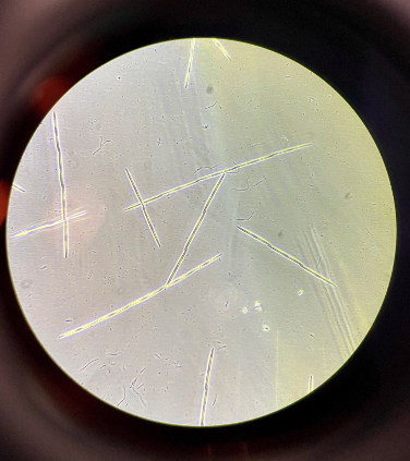
Certain diatom species in the genus Pseudo-nitzschia can produce the potent neurotoxin domoic acid. At temperate latitudes these species often form large harmful algal blooms; seafood contaminated with domoic-acid-producing diatoms can cause amnesic shellfish poisoning in wildlife and humans. Toxic blooms of Pseudo-nitzschia have been documented in many regions, yet domoic acid has never before been reported in the high Arctic at latitudes like 83 °N—the latitude reached by our MicroSHIFT cruise. We hypothesise that toxic Pseudo-nitzschia species might be thriving within and under the ice, at such high latitudes.
Finding domoic acid at 83 °N—even where no commercial fisheries operate—would signal an important change in Arctic marine chemistry. Ice-associated zooplankton and benthic invertebrates could accumulate the toxin and pass it up the food web to seabirds, polar cod and marine mammals that feed beneath the ice.
Is there a toxin accumulating under our “Kindergarden” and in Arctic sea ice? One of the objectives of MicroSHIFT is to find an answer to this question.
Our sampling strategies
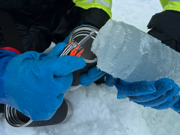
We search everywhere - we use a systematic approach to screen for domoic acid in the sea ice and in the water colmn at several depths.
We also keep an eye on the deep chlorophyll maximum (DCM) by making regular Rosette casts from the ship’s moon pool, which collect water from the surface all the way down to 4200 m (no photosynthesis there!). Phytoplankton such as diatoms are confined to the upper ~50–100 m where light is available.
Stress factors and toxin production
At lower latitudes, nutrient scarcity, grazing pressure and photo-physiological stress are often linked to domoic-acid production, but the exact trigger is still unclear. On board we therefore measure:
Nutrient concentrations Light intensity Photosynthetic performance of diatoms (Pulse-Amplitude Modulation fluorometry)
Samples are preserved for lab-based toxin analysis by LC-MS/HPLC. In parallel, we collect material for gene-expression studies (qRT-PCR and RNA-Seq). These molecular tools let us see whether the genes involved in domoic-acid biosynthesis are switching on—often hours to days before a toxic bloom becomes visible. Genetic data also help us identify the transcription factors that link environmental stress to toxin production.
Also, we isolate and cultivate diatoms from our samples on board to conduct targeted lab experiments under controlled conditions once back on land, in order to gain further insight into the physiological, biochemical, and genetic factors underlying the potential production of domoic acid.
Is there biochemical warfare under the sea ice at 83N? And if so, what drives it? We will find out soon!
Collaboration
This work is a collaboration between Dr Karley Campbell (UiT) and Dr Michele Fabris (University of Southern Denmark, mif@igt.sdu.dk). The Fabris lab specialises in diatom synthetic biology, biotechnology and natural-product biosynthesis, including pathways that produce and use precursors such as geranyl diphosphate, such as domoic acid.
_________________________________________________________________________________________________________
Time for some "net-working"
(Credit: Miriam Marquardt, Engineer @ UiT)
While many on this cruise are focused on microbes, I took on the challenge of searching for zooplankton and ice-associated fauna – the hunters of ice algae. Every third day we walk out to the little green ice tent that covers a large hole on our ice floe. Through this hole, we can deploy ROVs (Remotely Operated Vehicles), AUVs (Autonomous Underwater Vehicles), CTDs (Conductivity-Temperature-Depth profilers), but also nets.
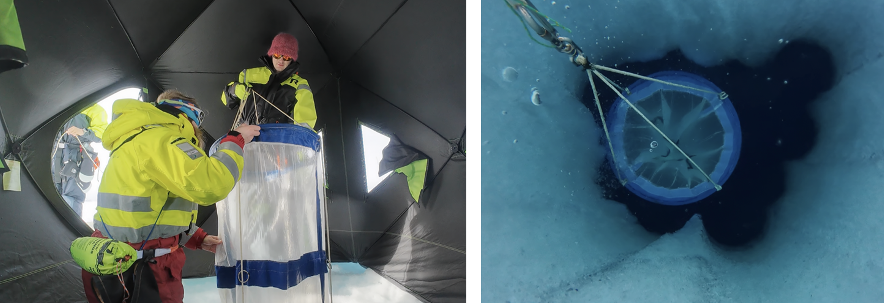
To catch zooplankton in the water column from 50 meters up to the surface, we use a WP-2 net with a mesh size of 90 µm. So, what do we catch in the net? Not fish—much to the disappointment of our bear guard, Einar—but instead, lots of tiny crustaceans just a few millimeters long! Among them are copepods—sometimes referred to as "the cows of the sea"—which are tiny but essential grazers of microalgae in the Arctic marine ecosystem. We caught several species of copepods in various sizes and developmental stages, as well as some amphipods, "the tigers of the sea" (arrow worms), and occasionally a comb jelly called the "sea nut" (Mertensia ovum).
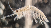
We affectionately call our ice floe "the kindergarden", and this nickname isn't far from the truth. When looking into the brine channels and the water just beneath the sea ice, we find a host of juvenile zooplankton species—for example, nauplius larvae of copepods and tiny copepods invisible to the naked eye. These small creatures aren't limited to the water under the ice; some even venture into the extremely salty and cold brine channels within the sea ice itself to feed on tasty ice algae and to hide from predators. These organisms are known as sympagic (ice-associated) fauna.
To sample both fauna and flora within the ice, we drill ice cores. We usually focus on the lowermost centimeters of the ice, where most of the algae live because they can access the most nutrients here. In these bottom sections, we found copepod nauplii and small copepods, as well as rotifers, a diverse range of ciliates, and occasionally an amphipod.
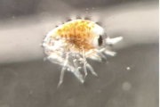
Back in the lab at UiT, we’ll continue analyzing the samples to assess the abundance and biomass of zooplankton and ice-associated fauna. These data will help us estimate grazing pressure on the ice algae during our drift—and determine whether we experienced more of a match or a mismatch situation.
_________________________________________________________________________________________________________
What happens when we open a window through the Arctic ice?
(Credit: Laura Dalman, Institute for Marine and Antarctic Studies, University of Tasmania)
During our time on a drifting ice floe in the Arctic Ocean, I spent my days shovelling snow – morning, noon, and night. The winds howled, the temperatures dropped, and still, I kept clearing snow from the ice. Why? To understand how a simple change in light might ripple through an entire ecosystem.
Snow can act like a thick curtain, blocking sunlight from reaching the ice below. But just beneath that icy surface live microscopic algae – tiny photosynthetic organisms that form the foundation of the Arctic food web. These algae capture carbon and feed everything from zooplankton to fish, seals, and even polar bears.
Many ice algae are perfectly suited to the dim conditions under snow-covered sea ice. But the Arctic is changing. As trends suggest that the ice is thinning and a potential reduction in snow cover, more sunlight may reach these communities. How will they respond?
To find out, we cleared patches of snow, creating brighter windows through the ice. Some patches were left for just 24 hours, while others were monitored over several weeks. We wanted to see if the algae could adapt quickly – or at all – to the sudden burst of light. Could they take advantage of it? Or would it stress them out?
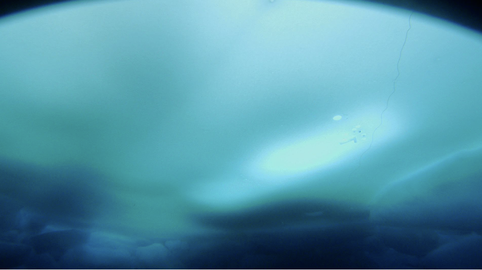
Think of it like humans on a hot day. Just as we sweat to cool off or apply sunscreen to protect ourselves from the sun, algae have their own sun-shielding tricks.
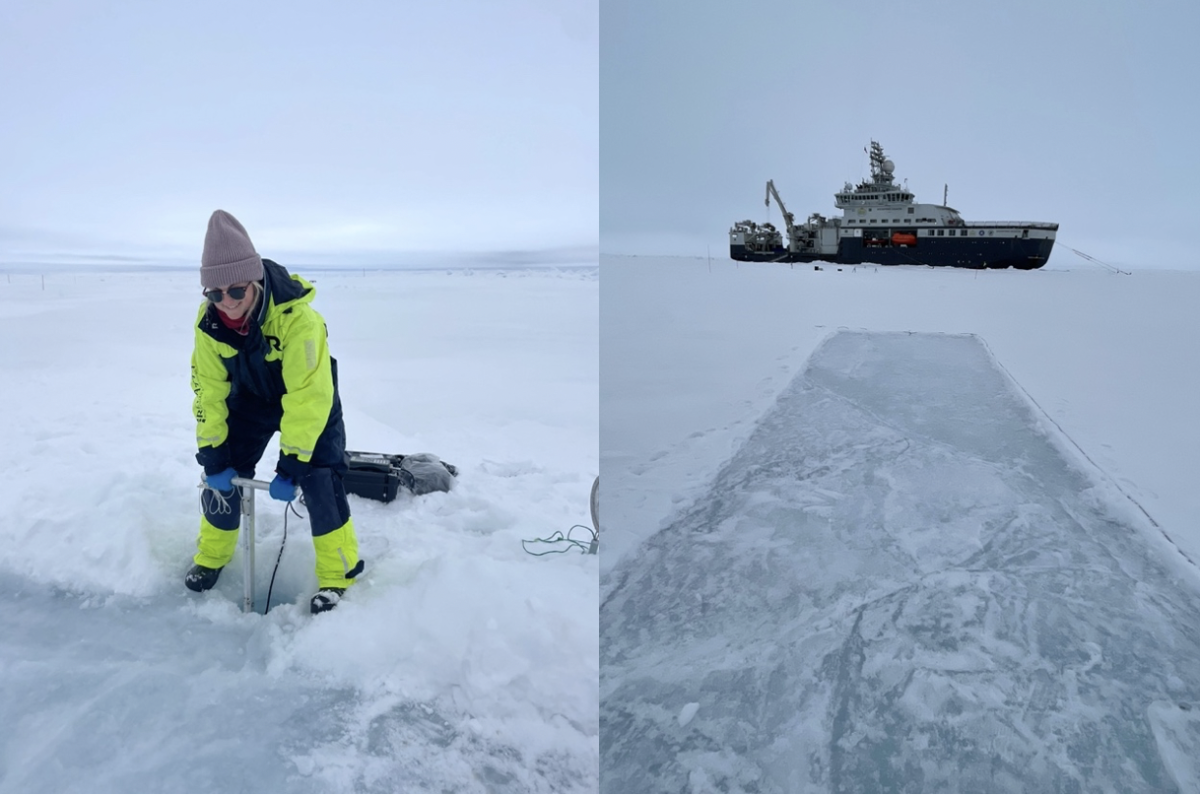
Each day on the ice brought us closer to understanding this hidden world beneath our feet.
Thanks to a Scientific Committee on Antarctic Research (SCAR) fellowship, I’ll be taking what I’ve learned here in the Arctic and applying it to similar communities in the Antarctic. It’s a chance to see how polar algae on both ends of the Earth are responding to a rapidly changing world.
_________________________________________________________________________________________________________
31 May, 2025
The last ice
(Credit: Georges Kanaan, PhD Student @ University of Washington)
We have been on our way back to land for a couple of days now, yesterday evening I finished packing my lab and cleaning it, it is now ready for the next team of scientists. With every passing moment this bittersweet feeling grows. I am happy to go back to eating my favorite snacks and cooking for myself, but I will miss Kenneth’s (the chief steward) pancakes (it’s his grandma’s recipe!). I am happy to see friends again, but I will miss the new ones I have made on board. I am happy to be back on land, but I will miss the ocean. I will miss the sea-ice.

As the ship slowly moves south, I can start to make out Svalbard in the distance, though we are still surrounded by ice, our port seems closer and closer. The ice cover has been thinning progressively. Sometimes we’ll pass through an area with much denser ice cover, and I feel more happy, as if my contentless flows with the fraction of the ocean covered by ice around me. I do not want to leave, and for a moment I can believe the captain has mistaken North for South. But of course he has not, the currents have simply grouped together solitary floes. They were once much larger, and frozen to others, before they floated south and were broken by the currents and melted by the warmer Atlantic waters. Is that what is happening to me? Is my little group of scientists turned friends being broken up by the warming ocean as well? No, I take solace in knowing I will see many again at conferences, future expeditions, etc. They are now my colleagues for life. That’s one of the nice things about the polar marine science community, it’s tiny! Still, I must appreciate these last moments together, and these last moments with the ice.
"Ok, from now on, we need to spend at least 20 minutes per day out on the helideck!" I told Megan, "Deal" she replied. We like to go out and just be present with the ice, see, listen. At first glance it may seem like a vast expanse of white, but look a little closer, stay a little longer, and things appear. A tall ridge formed by two floes crashing into each other, a big lead formed by two floes being dragged apart from each other, snow dunes over there, grey ice over here, oh and a bit of Nilas right beneath the ship! Listen to the cracks the ice makes as we break through, low and rumbly when we crash into thicker ice, and almost soft and smooth when we swim through much inner Nilas, pushing it to raft over its neighbor. I am reminded that the first explores just had to look in this way, with a little patience, to make great discoveries. There is so much to learn just from observation. Past wind patterns are inscribed in the snow distribution, as are snow fall events, the abundance of photosynthesis beneath the ice (or lack thereof) is hinted at by the color of the chunks of ice the ship flips over. Look, and listen, I’ve been here for weeks but that has been hard to do, to be present, as work has been non-stop. But now it has paused, and I must take advantage.
I never know if the piece of ice I see will be the last one, it annoys me. When I think it will be, I look at it very hard, try my very best to be very present, commit its shape to memory, remember what it makes me feel to see it, focus, focus, focus… wait there’s another piece a few hundred meters away. Inevitably I am taken back inside the ship and distracted by a warm discussion with friends, dinner, a book, or anything else, and the next time I think to look out a window, it is the ocean waves that great me. No longer dampened by any ice the waves are free again to roll the ship, I feel them, and now I know I will no longer see any sea ice. In my heart I say goodbye, thank you, and see you next time. Now is the time for us to go back home and make sure our time here was well spent, analyze the data and learn about the ecosystem so that we may help preserve it for all of us, for all the polar bears, the seals, the algae, the zooplankton, the Bacteria, the fish, the shrimp, and everyone else for whom the sea ice provides a home.

4 June, 2025
We reach port in Longyearbyen, Svalbard, marking an end to the first of four field seasons in the Micro-SHIFT project. Scientists will return to their laboratories to analyse the many samples and datasets collected. This drift was only made possible by the hard work of Einar Eliassen Berntsen to keep everyone safe while on floe, as well as the highly skilled captain Karl Robert Røttingen and crew of the RV Kronprins Haakon. Thank you all! Tussen takk!
